
![]() Download Product Description
Download Product Description
Download Inversion Tutorial
Download Ground TEM demo database
(works with our EMIGMA Demo)
The TEM software package allows Ground and Borehole TEM and can be acquired as part of EMIGMA Premium Complete, as an add-on to other EMIGMA Premium licenses or as a standalone product.
Ground applications include fixed and moving loop configurations, with measurements taken at the surface (inside and/or outside of the loop), while borehole applications are based on a fixed transmitter with measurements down a borehole (with a probe). EMIGMA allows for both single- and multi-component receivers. Typical field conventions are used for data components and modeling. The import procedures set up the survey configuration, and the location and orientation of receivers are stored in EMIGMA ready for interpretation or modeling.
EMIGMA is an excellent tool for geophysical survey design as well as for interpreting measured data. The user may utilize single loops, profiles or boreholes or integrate multiple loops, profiles or boreholes. 3D visualization allows one to view the locations of boreholes in 3-space.
Data Import
- Calibrated imports from the manufacturer's format including Geonics Protem, Geonics EM61/63, UTEM3 and UTEM4, Zonge, SIROTEM, Crone, TEM-FAST, terraTEM, Phoenix, VTEM
- Generic AMIRA format
Data Processing and Correction
- 1D digital and spatial filters
- Simple and weighted averaging decimation
- Data Corrector tool combining dynamic spreadsheets and line plotter for data cleaning, missing data interpolation and simultaneous plotting of different data channels for fast cross-analysis
Data Display and Analyses
- Quick toggles between time channels
- Multi-channel grids
- Display of Apparent Resistivity as a surface or spatial contour
- Display of 3D section cutting of models in the 3D Visualizer
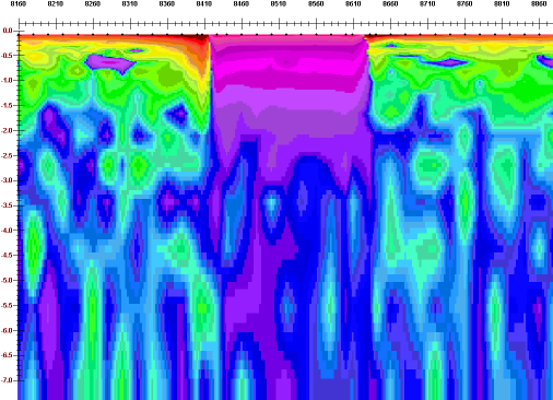
- PEXShow tool - 2D representation of geoelectric sections
- Grids: Natural Neighbor, Delauney Triangulation, Shepard & True-to-Data, Minimum Curvature and Thin-Plate-Splines
- Contours: 2D and 3D surfaces
- Time decay contours
- Line plots
- Residual plots
- For more detailed data display capabilities, see EMIGMA Complete
3D Modeling
and simulated data overlay
- Fast and accurate 3D simulations: model suite generation and batch mode
- Unlimited prism, thin-sheet plate and polyhedra targets
e.g. pipes (hollow cylinders with or without lids), ellipsoids, shells, bullets, landmines, drums, spheres, general polyhedra... - Multiple body interactions
- Variations in resistivity, susceptibility and Cole-Cole parameters
- Modeling of topography effects - Synthetic Topography
and Poly Generator - Modeling of some of the magnetic effects in EM data
- Ability to handle full contrast between host and bodies
- Interactive 3D model building tool
- CAD model imports
1D Inversion
- In-Loop or Out-of-Loop inversions for both moving and fixed transmitter survey configurations
- Smooth Occam and non-smooth Marquardt algorithms - Two-layer inversion for mapping overburden or depth to basement and multi-layer inversion for up to 19 layers of non-uniform thickness
- Incorporation of GPS_Z information
- Multi-station inversions for laterally constrained results
- Multi-component to reduce model ambiguity
TEM Pseudo Inversion
- Inversion based on contoured time decay constants.
- Conductivity-Depth imaging
Data Export
- Model Export to postscript files or raster formats
- Inversion Export to XYZ ASCII file (containing station, position, depth and apparent resistivity) to allow for the geoelectric sections to be utilized in other plotting or printing applications such as Geosoft or Surfer
- Depth slice and volume exports
- Model export to 3D CAD
- Model data and processed data export to XYZ or Geosoft format
- Export to EMIGMA database or Petros PEV file format permitting you to share your results with colleagues